
For many people, finding a destination now involves little more than entering an address into a smartphone.
Satellite navigation systems provide directions, estimated arrival times and alternative routes, often adjusting automatically when traffic conditions change.
Yet traditional maps continue to hold a particular appeal.
From historic atlases and detailed walking maps to decorative city plans and specialist charts, maps remain useful objects as well as fascinating records of how people understand the world.
The Long History of Mapmaking
People have attempted to represent geographical information for thousands of years.
Early maps varied enormously in purpose and accuracy.
Some were designed to show routes between settlements, while others reflected political boundaries, trade networks or contemporary beliefs about geography.
As exploration, surveying and mathematical techniques developed, maps became increasingly detailed.
Improvements in printing allowed geographical information to be reproduced and distributed more widely.
By the nineteenth century, systematic mapping had become important for government administration, engineering, transport and land ownership.
In Britain, the Ordnance Survey developed into a major source of detailed geographical information.
Why Paper Maps Offer a Different Experience
Digital navigation is exceptionally convenient when travelling to a specific destination.
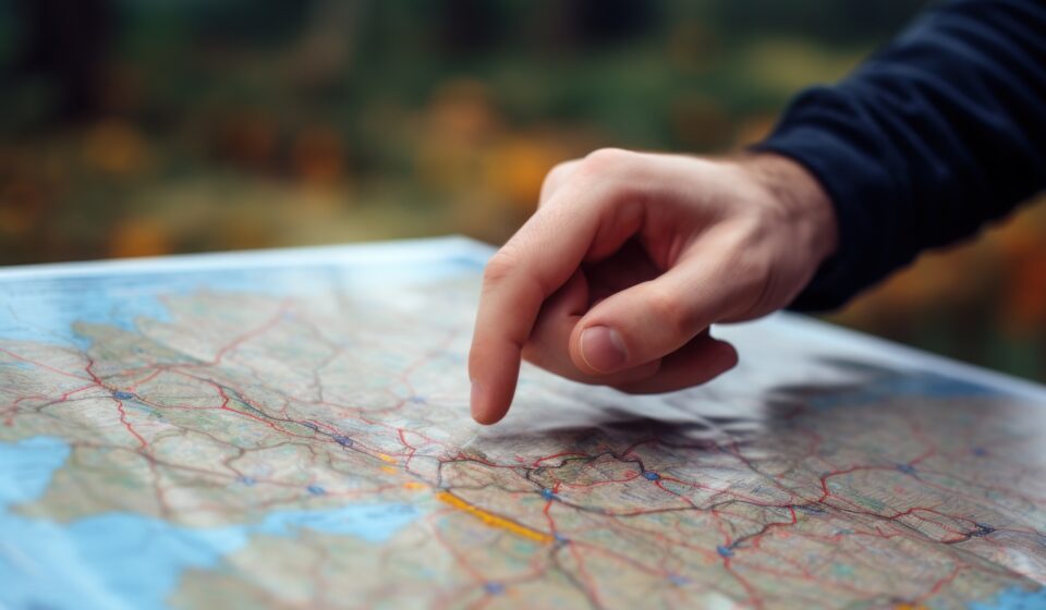
However, paper maps encourage a different way of looking at geography.
Rather than concentrating on the next turning, a reader can examine an entire region and understand how different places connect.
Hills, rivers, settlements and roads become part of a larger picture.
This broader view can be useful when planning walking routes, cycling journeys or trips involving several destinations.
Paper maps also work without a battery or mobile signal, making them a valuable backup in some circumstances.
Maps as Historical Documents
Old maps can reveal how dramatically places have changed.
A map produced a century ago may show railway lines that no longer exist, industrial sites replaced by housing or streets altered by redevelopment.
Comparing maps from different periods can help explain the growth of towns and cities.
They may also reveal changes in coastlines, land use and transport infrastructure.
For local historians and people researching family history, maps provide important context.
An address that no longer exists might still appear on an earlier street plan, helping researchers understand where people lived and worked.
The Art of Cartography
Creating a readable map involves much more than accurately recording geographical features.
Cartographers must decide which information to include and how to present it.
Colours, symbols, line thicknesses and typography all influence how easily someone can interpret the result.
A road atlas has different priorities from a geological map or a walking guide.
A map designed for tourists may highlight attractions and public transport, while a topographical map places greater emphasis on terrain and elevation.
Because space is limited, cartographers often simplify certain details to make the most important information clearer.
This process is known as generalisation and is essential to effective map design.
Why Maps Can Never Show Everything
Every map represents a selection of information.
Even highly detailed maps cannot display every object, feature or temporary change.
The way a map is projected also matters.
Representing the curved surface of the Earth on a flat page inevitably introduces some form of distortion.
Different projections preserve different geographical properties, such as local shape, area or distance, depending on their intended use.
This means that familiar world maps may make certain countries appear larger or smaller relative to others than they actually are.
Understanding these limitations helps explain why no single map is ideal for every purpose.
Digital Maps Have Changed Expectations
Online mapping systems have introduced capabilities that traditional printed maps cannot easily provide.
Users can search for businesses, view satellite imagery, explore street-level photographs and receive live traffic information.
Routes can be recalculated automatically when conditions change.
Digital maps can also be updated more frequently than printed editions, although their accuracy still depends on the quality of the underlying data.
These features have made navigation easier for millions of people.
However, relying entirely on turn-by-turn instructions may mean paying less attention to the wider geography of a journey.
The Appeal of Collecting Maps
Maps are also collected for their historical, artistic and personal significance.
An old railway map might appeal to a transport enthusiast, while a vintage city plan can provide an attractive reminder of a familiar place.
Some collectors focus on particular regions or periods.
Others enjoy unusual designs, decorative illustrations or maps created for specialist purposes.
Modern map-inspired artwork has also become popular in homes and offices.
Stylised city layouts, topographical prints and personalised location maps demonstrate that cartography continues to influence contemporary design.
Finding a Place for Both Formats
Paper and digital maps do not need to compete.
A smartphone may be the most convenient tool for navigating unfamiliar streets, while a printed map can provide a better overview of a large area.
Walkers may use digital location tools alongside physical maps to understand terrain and plan alternative routes.
Historians can compare old printed maps with modern digital imagery to investigate how places have developed.
Each format offers different advantages.
More Than Directions
Maps help people understand relationships between places, identify patterns and explore environments beyond their immediate surroundings.
They can be practical tools, historical records and works of design.
Although satellite navigation has changed how most people travel, it has not removed the value of understanding geography.
Sometimes, looking at the whole map tells us much more than simply following the next instruction.